Experimental URI Hurricane Boundary Layer Model Forecast Products
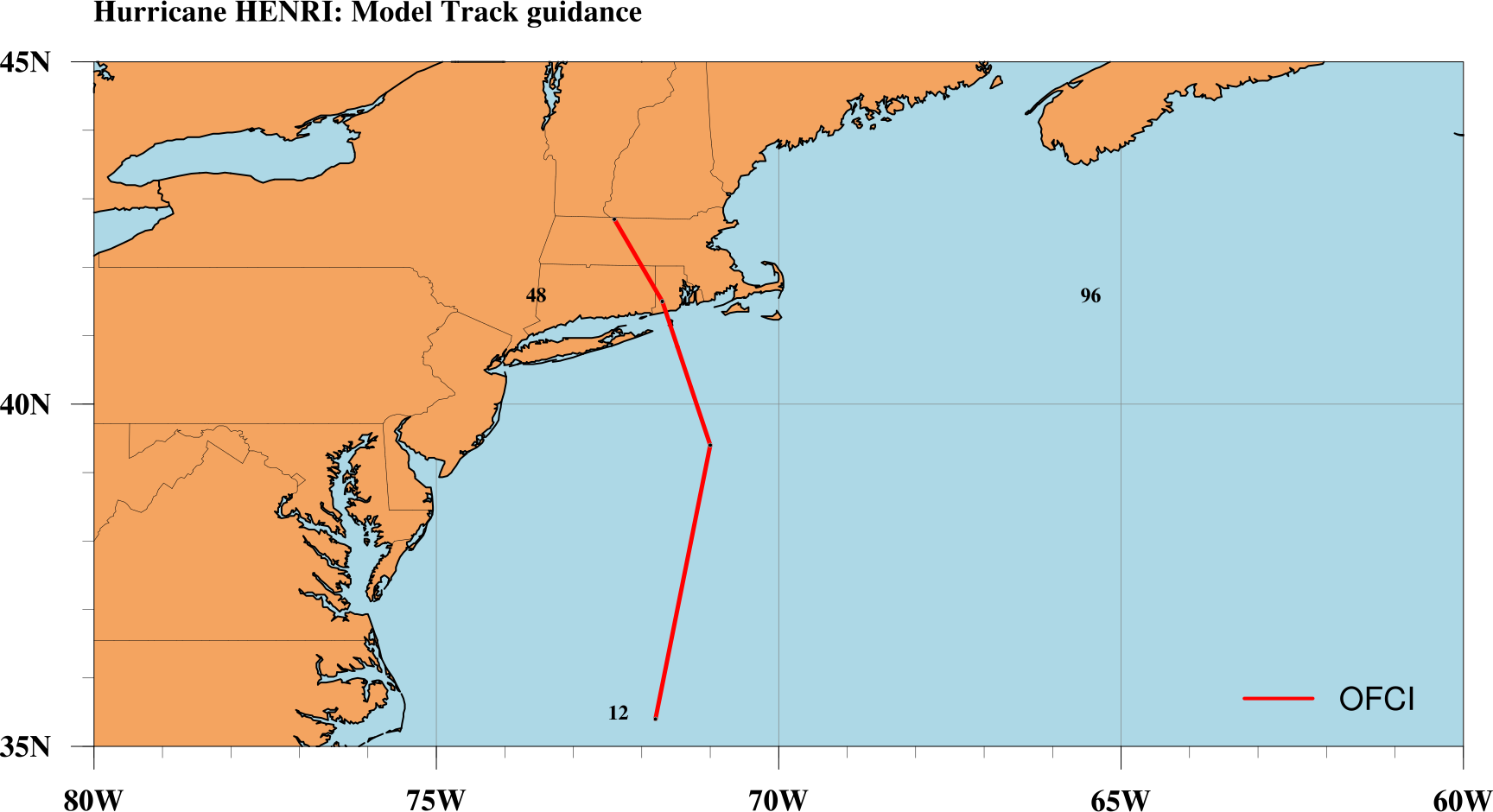
URI-HBL Surface Wind Forecast
Click over the image for animation

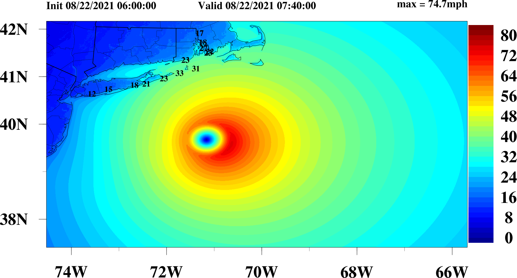
Maximum Wind Speed
Click over the image for larger view

Radius of Maximum Wind
Click over the image for larger view
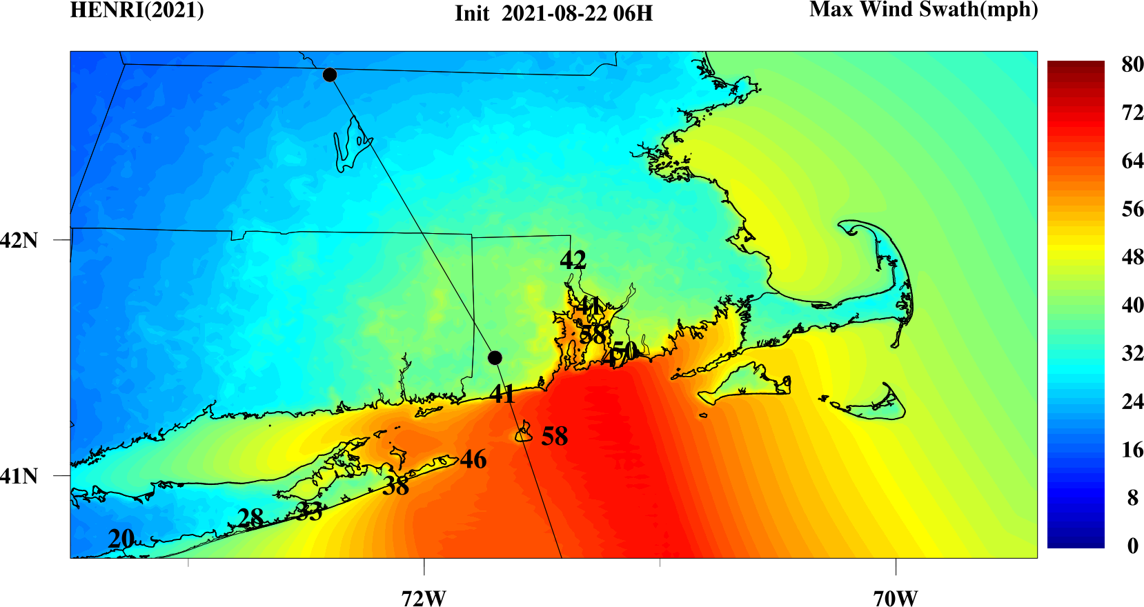
Maximum Wind Swath
Click over the image for larger view