URI Hurricane Boundary Layer Model Forecast Products

Track
Click over the image for larger view
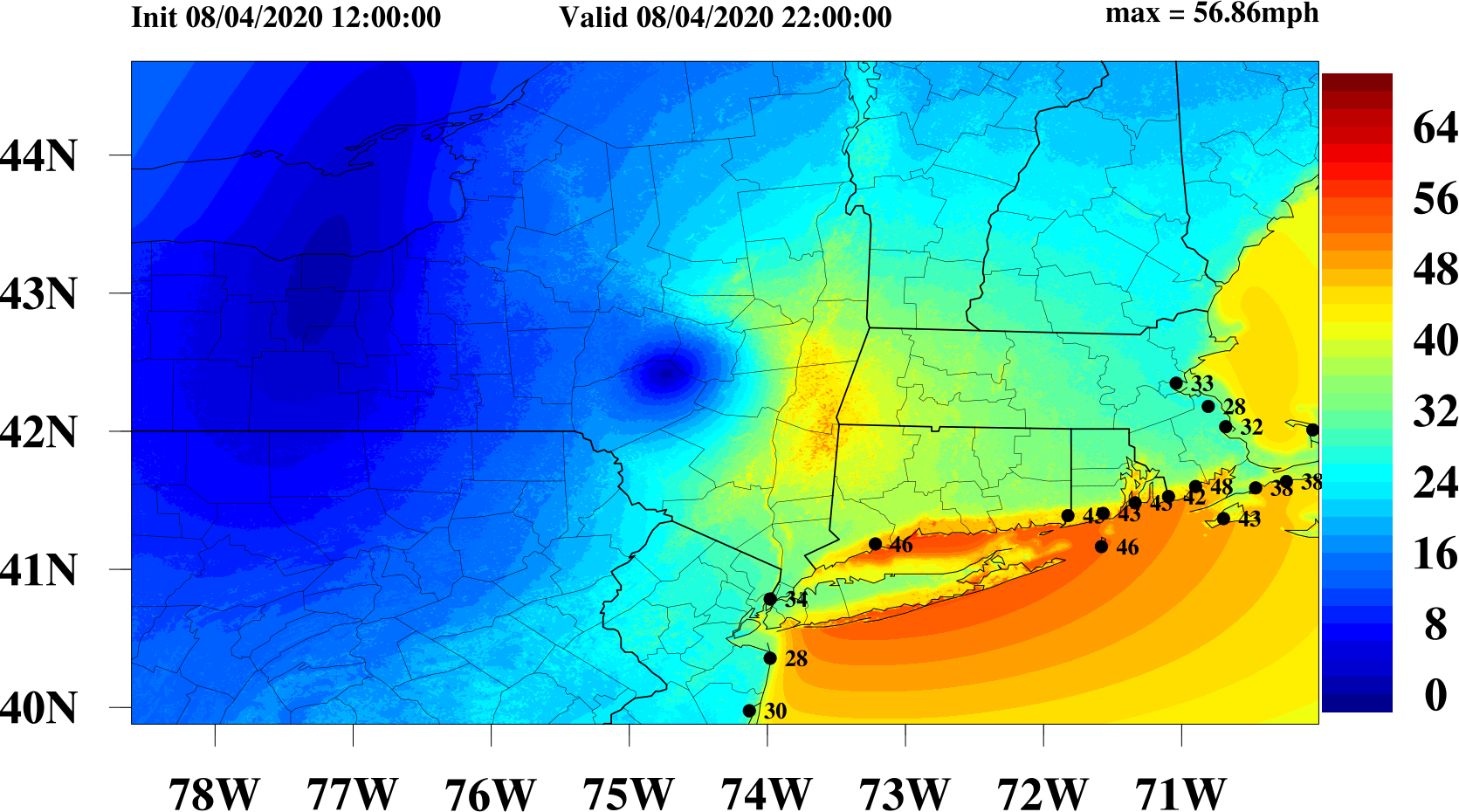
URI-HBL Surface Wind Forecast
Click over the image for animation
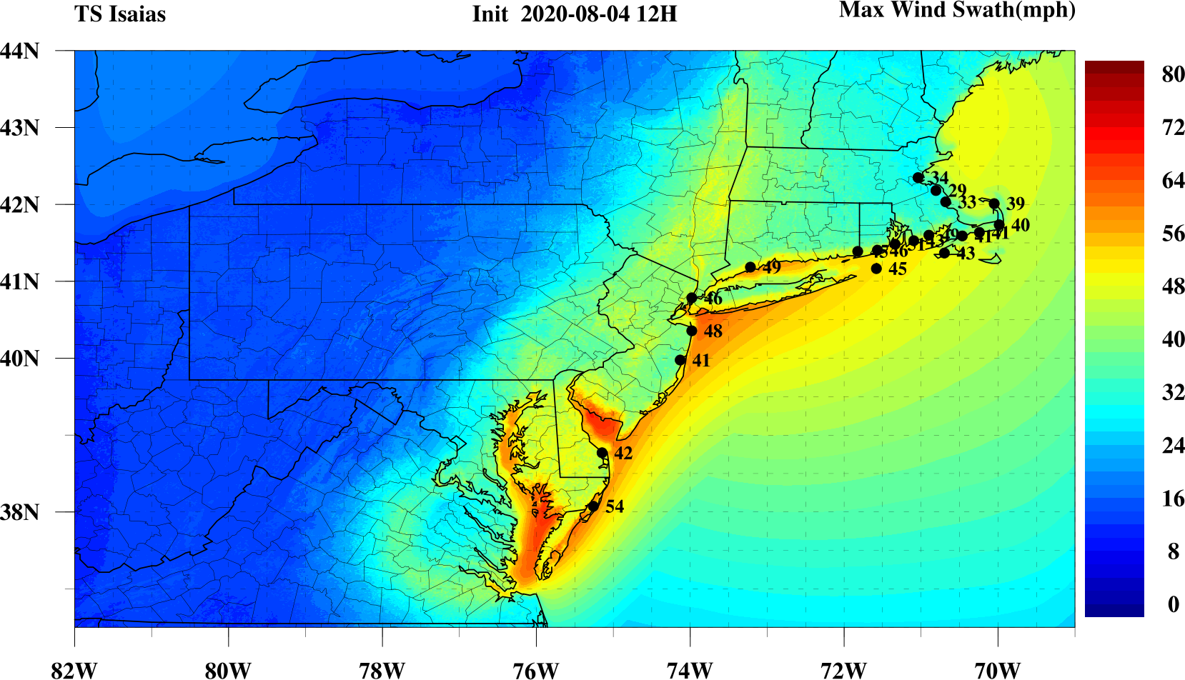
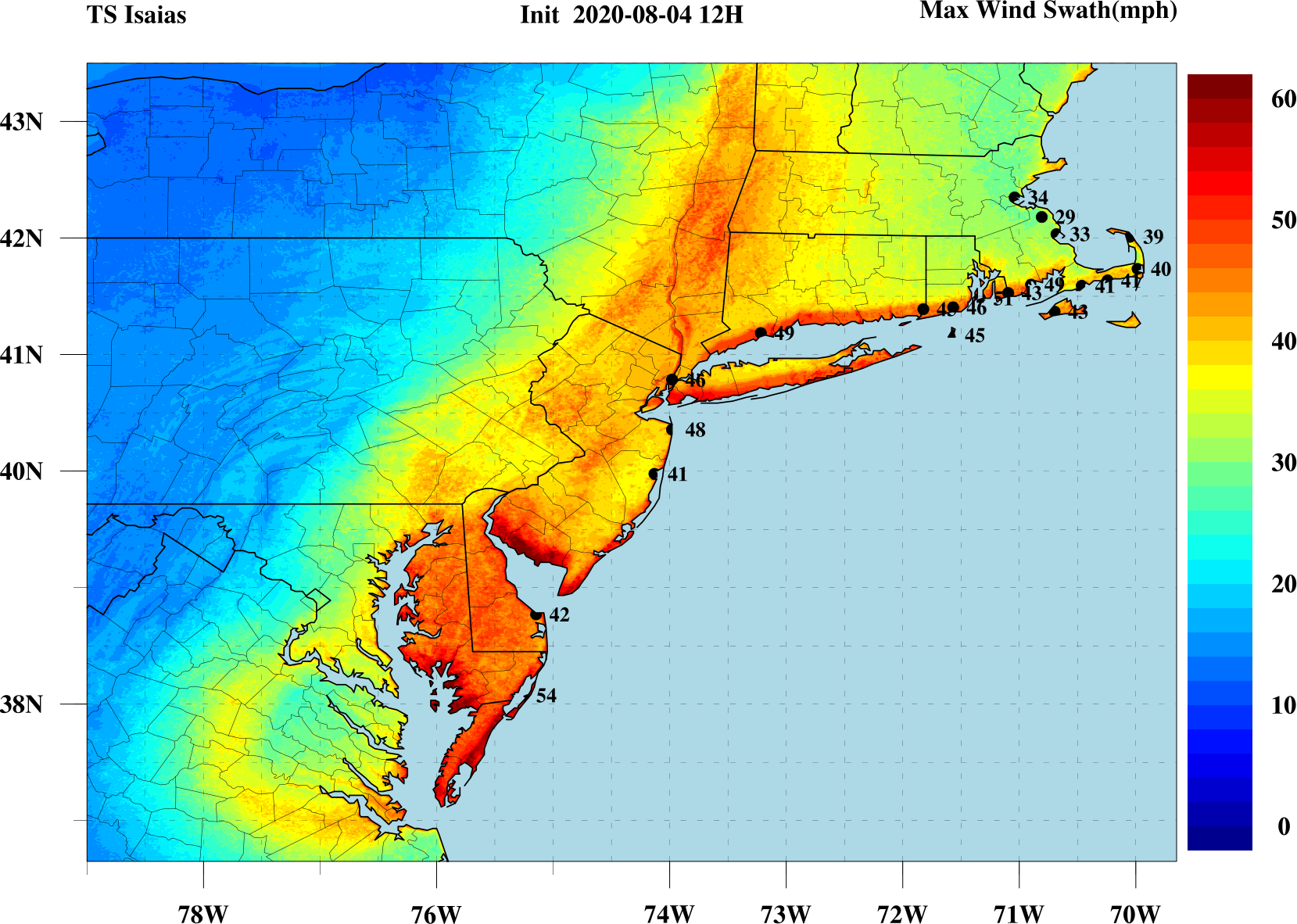
Maximum Wind Swath
Click over the image for larger view
Maximum Wind Swath(Northeast US)
Click over the image for larger view

Maximum Wind Swath(South and North Carolina)
Click over the image for larger view